Urbalytics
Winning project from the 4th Open Call funded by the AI4Copernicus Project
Companies: Latitudo 40 / LAND Italia
Country: Italy | Domain: Other (Urban Monitoring and Planning)
An interview with the winners – Mauro Manente, representing the Urbalytics project
Q: What was your motivation for creating this proposal?
A: Latitudo 40 and LAND respectively provide information and solutions to make cities more sustainable. We could not miss the opportunity to demonstrate how the AI algorithms applied to Sentinel 2 images by Latitudo 40 and the LIM methodology developed by LAND could be combined to provide a complete solution for Urban Heat Islands mitigation, supporting a data-driven approach to bring nature in our cities.
Q: Which is the most critical impact (societal or other) that your project could make (if you could name one)?
A: The impact of climate change on cities is evident on cross-cutting issues ranging from energy to citizens’ health. The experiment we will conduct with the cities of Naples and Milan aims to create an abacus of Nature-Based Solutions for mitigating the consequences of extreme heat, generating a positive impact on air quality, energy consumption and citizens’ health and quality of life in urban spaces.
Q: Considering the recent funding received through the AI4Copernicus Open Calls, do you have any plans for further development of your idea?
A: During the experiment we will validate the AI algorithms on Copernicus images and their combination with the LIM methodology, which will allow us to engineer a replicable and scalable solution to be proposed first to European cities and then extended to the rest of the world.
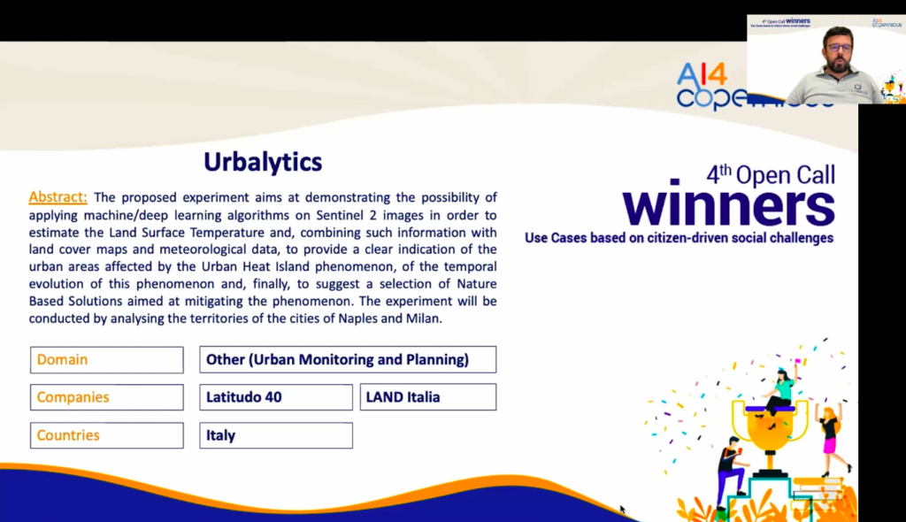
A few words about the project: The proposed experiment aims at demonstrating the possibility of applying machine/deep learning algorithms on Sentinel 2 images in order to estimate the Land Surface Temperature and, combining such information with land cover maps and meteorological data, to provide a clear indication of the urban areas affected by the Urban Heat Island phenomenon, of the temporal evolution of this phenomenon and, finally, to suggest a selection of Nature Based Solutions aimed at mitigating the phenomenon. The experiment will be conducted by analysing the territories of the cities of Naples and Milan.